Fri 06 Aug 2010 06:21 » Jon
Despite the best efforts of the storms, the snow, a bear and a load of mountains, I arrived back at sea-level yesterday at 16:20, just over 7 weeks after leaving Hendaye. The journey (which was roughly 800km with 40,000m of climbing) took 50 days, 20 hours and 50 minutes in total, including 6 rest days.
In keeping with the theme of the trip, the weather threw one last curve-ball, and I spent the morning in gloves and a wooly hat. Despite being only hours from the Mediteranean, the bitterly cold northerly wind made it feel like winter. I set off in sun feeling reasonably warm but soon arrived in cloud, and after an hour or two my hands were so numb I was having trouble turning on the GPS! I was also regularly blown off the path, sometimes by three or four steps, so it wasn’t quite the easy stroll to the sea I’d hoped for!
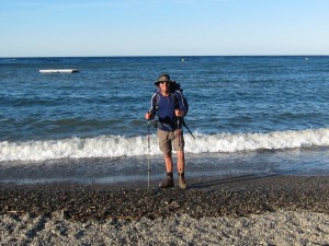
It was fantastic to see the sea getting closer though, and during the afternoon I slowly dropped from 1,000m down towards Banyuls, with the temperature gradually increasing as I went. The wind wasn’t quite so violent lower down, but was still pretty strong even down in the village.
Klaas and I had discussed what it would be like reaching the beach and we’d both got quite emotional just thinking about it, but I think spending the last nine days on my own gave me time to prepare, and the emotions weren’t nearly as strong as I’d expected. When I finally walked across the stoney beach, picking my way through the sun-bathers, my main feeling was “these guys must think I’m a little strange, standing in the sea in my boots…”
The beach itself was very crowded, so I retired to the promenade and sat for a while, made a few phone calls and considered things. The guidebook warns that it will take weeks to let the achievenment sink in and work out how you feel – right now that seems pretty accurate.
I had the obligatory Coke and Magnum in honour of the Dutchman, inspected the artwork on the Hôtel de Ville commemorating the end of the GR10, then waited for my friend Al to arrive.
Wed 04 Aug 2010 18:00 » Jon
Before I left home I marked the route of the HRP on my maps and cut out the strip of the map I needed for the trail. As I’ve slowly ambled east I’ve been throwing away the used maps, and at times even tearing off the left hand side day-by-day, all in a bid to keep the weight down. The problem with this strategy is that when I look back west, it’s impossible to identify any of the peaks I can see! As I’ve dropped slowly towards the sea the last few days I’ve had some great views, and it’s been frustrating not having a big map to work out exactly where Carlit and Canigou fit in.
When I did Canigou on Sunday there were low clouds to the east, so I couldn’t see the sea, but when I climbed Roc de Frausa on Tuesday I got a fantastic (and rather emotional) view of the Mediteranean.
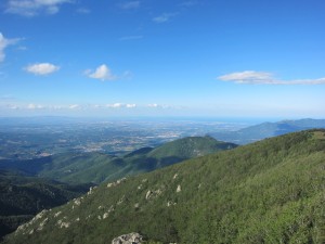
The weather on Tuesday was a lot better than during the descent to Arles the previous day, and I dried out the tent and clothes during various rest stops. The morning brought a 700m climb, but the day’s main feature was the 900m climb to Roc de Frausa, which took most of the afternoon.
Normally I’ve been carrying 2 litres of water, but I left Arles with 3, as it’s hotter and drier here – I’m drinking more and finding water points less frequently. Unfortunately there was nowhere to top up, and by mid-afternoon I was out. I decided I could probably last the remaining couple of hours but was very relieved to hear a little trickle of a stream not too far off the path. I gave the purifying tablets 10 minutes to work their magic and climbed up alongside the stream, noting the cow hoof-prints in the mud and hoping the water wasn’t too horrendous, then drank about half a litre straight from the bottle. I put the rest into the bag for my drinking system and was slightly disturbed to see that it was a dark yellow colour!
I avoided drinking much more, climbed over the top and dropped down into Spain, to stay in an unmanned refuge. It was part of a bigger building, but was basically just a room with a fireplace, a table and space for 12 people to sleep, all kindly provided by a Spanish mountaineering organisation. As I settled in I wondered why I hadn’t used the unmanned refuges more.
Soon after I got there a French guy showed up, doing the GR10 backwards, so 2 days into his trail. We discussed travelling solo and it turned out he was quite used to it – he spent a year and a half cycling from France to China!
Today was one of the hottest days so I was glad it was mainly downhill in the morning. It was almost all on dirt road, leading slowly down to a strange shopping hell called Le Perthus, which is currently vying with Gibraltar for second spot in the list of places I should avoid in the future. I spent about 3 hours in Benidorm once, and that was enough for it to secure first place.
After the obligatory Coke and Magnum, I set off up towards Col de l’Ouillat. I followed the book’s instructions but was a little disturbed to see the signs for the GR10 (which I was on at the time) turning off the road. The map agreed with my book, so I stuck with them, ignoring the signs.
Eventually the route I was following reconnected with the GR10′s new route, and I made a schoolboy error, turning the wrong way onto the trail. It took me five or ten minutes before alarm bells started ringing and I retraced my steps.
The climb was fairly straightforward after that and I’m now at Col de l’Ouillat, dreaming of reaching Banyuls tomorrow.
Mon 02 Aug 2010 19:50 » Jon
When I left Estany Bleu, my home on Friday night, I climbed back onto the ridge I’d been following from the top of the Vallée d’Eyne, and carried on heading east. The guidebook suggested dropping down to Refuge Ull de Terr but I’d been advised to stick to the ridge, so I bagged a few more summits, including Bastiments at 2,881m, with some magnificent views.
I began feeling a bit low as I came along the ridge – partly because I wasn’t following the book and so had no way of guaging progress, and partly because I was worried about where to get water and where to camp that night.
Walking on a ridge gives fantastic views but there are no streams – I had the remains of the two litres I’d left the lake with, but if I’d ended up camping somewhere without water then that wouldn’t have got me far. In the end I dropped about 100m off the ridge and found a nice clean stream where I filled up, leaving with over three litres, which I figured would get me through the night.
The destination for the evening was a more tricky question – I really wanted to press on so I could attack Canigou the next day, but didn’t want to be tired from going too far. There were two places on the map I’d selected, about an hour apart, but when I reached the first there was a jeep parked there and signs banning camping, so I headed on to the second possibility.
As I approached Pla Guillem it looked much more promissing, and I found a nice stream just below the plateau. As I began looking for some flat ground though, a dog arrived and started barking and growling. There was a tense stand off for ten minutes or so, but eventually I decided the ground was too slopey and I didn’t fancy having my tent shredded by a territorial dog, so I moved up the hill a bit and the dog seemed happier with my second choice of bivouac spot.
Yesterday was all about Canigou. From Pla Guillem I dropped down to Refuge de Marialles, then began the long approach to the famous mountain. On the way I passed loads of people heading down – there’d been a race to the summit earlier in the day, and there was a constant stream of competitors and organisors descending.
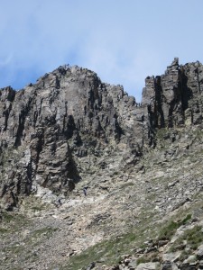
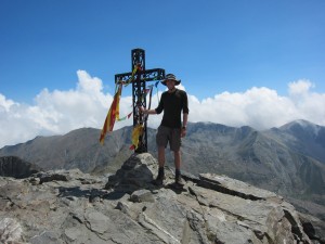
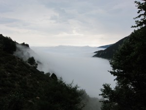
Eventually the stream died away, and I approached the final climb up a chimney. Looking from a distance (1st photo) it’s hard to believe that the route is possible without climbing gear, but when you get close you realise it’s possible to scramble up the enormous natural staircase. It’s one of the most exhilerating climbs I’ve done on the HRP – just at the right level to be doable but scary at the same time – and the top of the chimney is right next to the big cross with the Catalan flag on the summit (2nd photo). I couldn’t stop grinning when I got there – an awesome climb!
On the way down the other side to Refuge des Cortalets I met four teenagers heading up. It was about 16:30 and I was the last person I knew of on the mountain – I’d seen a family on the summit, but they were descending ahead of me. That, combined with the fact that the weather was beginning to look a bit stormy and the kids didn’t look very well prepared made me wonder whether should talk to them, but in the end I left them to it.
Over dinner in the refuge it became apparent that these four were missing. Their mother asked when I’d seen them and I began wishing I’d advised them against the climb, especially as it was raining by this time. Luckily the guardian of the refuge was also a mountain guide and knew the place inside out, so when the kids called he described an escape route and had them met lower down. I asked him later on if he thought I should have said anything and he said “no – they’ve learnt a valuable lesson!” They looked cold and scared when they got back later in the evening though – I don’t like to think what would have happened if they’d had no phone reception.
When the guidebook said this fifth section was “one final test”, it wasn’t kidding. I think today I’ve failed on several counts – after a day of storms, and with the skies still grey and menacing, I decided to camp, rather than find a hotel in Arles-sur-tech. As I arrived, the rain stopped and I actually saw blue sky briefly, but since I pitched my tent it’s been non-stop thunder, lightening and rain – at times so heavy that it was flowing under the tent. Unfortunately my rucksack is already wet from the storms today so I can’t bring it inside the inner-tent – instead it’s standing on my flip-flops in an attempt to keep it from getting completely soaked.
The day itself was fairly uneventful apart from the rain. I’m now about 2,500m lower than I was yesterday afternoon on the summit of Canigou, and about 1,900m lower than last night’s refuge – enough that my soap bottle has changed shape due to the pressure difference. It’s been a day of descent, with a 300m climb in the middle to break up the monotony and, for entertainment, a camp full of hippies proclaiming (in English) that they were living “without violence, pollution, business and electrical”.
The only other notable event from today was meeting a guy doing the HRP backwards. His plan is to go west as far as Roncevalles (day 4 of my walk), then find the GR11 and go back east to Banyuls. He reckons it will take him about three months…
The other day someone told me they’d imagined the HRP was a bit of a production line, where I would easily meet someone to do the final section with, now I’ve left Klaas behind. In reality things are a bit different: today’s chap was only the eighth person I’ve met who’s doing the HRP, in the seven weeks since I started, and since he was going backwards he was no use as company!
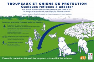
UPDATE: I was recently (Aug 2012) walking in the French Alps, and came across the sign in the fourth photo, warning walkers about livestock guardian dogs that live with the sheep and protect them. The dogs are introduced to the sheep as puppies, growing up protecting them as family members, and are then put out on the hills with the sheep to ward off any wild animals. One of the most commonly used varieties is called the Pyrenean Mountain Dog, which is the kind I met near Pla Guillem. At the time, I’d been surprised when a huge flock of sheep arrived shortly after the dog, and had wondered why the dog was keener on attacking me than the sheep, but now it all makes sense…
Fri 30 Jul 2010 18:40 » Jon
Yesterday morning began with an hour and a quarter climbing up a steep scree on the western face of Pic Carlit – the highest mountain in the Eastern Pyrenees at 2,921m, and the last time the HRP goes that high. The descent wasn’t generally as steep, but there were sections where it required scrambling using hands, so I was impressed by the number of tourists heading up.
This slowly turned to dismay as I walked down to Barrage de Bouillouse (second photo, taken from the summit of Carlit) – it was one of the most beautiful areas I’ve seen on the whole trail, but as I neared the dam the number of people rose exponentially.
After the dam, the trail headed slowly down towards a collection of ski resorts. This meant there were few opportunities to bivouac, and I ended up staying in a lovely Gite d’Etape (a kind of hostel) in Superbolquère, called Les Ramiers. I sat next to a French family during a very tasty dinner, told them about the bear, and showed them the photos of the damage to my tent and rucksack. A short while later the five year old noticed me finishing off everything that was offered and said “Mr Bear is very hungry!”
While yesterday clouded over in the afternoon, today has been non-stop sunshine. From the gite I dropped down into the first wide, flat valley I’ve seen in ages, but soon began climbing back up from 1,400m through the Vallée d’Eyne. I kept seeing signs reminding me it was a nature reserve, but the only remarkable thing about the valley that I noticed was the number of insect bites I picked up.
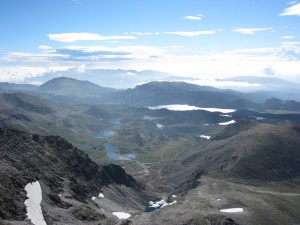
At the head of the valley the trail arrives on an impressive ridge, which seems to vary between 2,400m and almost 2,900m. I’ve already spent a couple of hours on it, and will be on it all of tomorrow. The third photo is from the Pic d’Eina (2,786m), looking back the way I’ve come, with Pic Carlit near the centre.
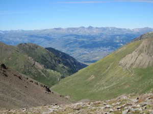
Camping on the ridge didn’t seem like a great plan, so I’ve dropped down just over 100m to a little lake. Much like two nights ago at the foot of Carlit, there are mouflon running around all over the place, seemingly playing a game!
I washed some clothes in the lake earlier and, as usual, began looking forward to having a washing machine. As I was hanging the washing up though, it struck me that that could be the last load I do in the mountains. I’m several hours ahead of the book’s schedule at the moment, so may be able to finish within six days, which I could probably manage without anymore washing. Suddenly the fact that the trip is almost over has begun to register. I’m going to miss these mountains.
Unlike two nights ago, tonight I’m quite happy to be on my own. I’m sitting in the evening sun at 2,600m, looking out over an amazing landscape, shared with only a few mouflon. Being able to just stop and pitch a tent wherever you like is a great feeling.
Wed 28 Jul 2010 19:04 » Jon
The highest point in the UK is Ben Nevis, at 1,344m. Since I left Lescun on 26th June (over a month ago), I hadn’t been below that level until yesterday, when Klaas and I hitched down to Ax-les-Thermes to find some decent shops.
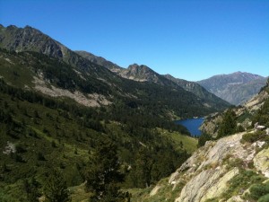
We had a pretty successful trip, finding fuel for the stoves, maps for the final section, food supplies and, of course, Magnums. Ax had a market going on, so we got some great dried fruit there – rather than just carrying peanuts and cashews, I’ve now got them mixed with raisins, cranberries, goji berries, banana pieces and papaya – it’s delicious!
Back at the campsite I drew the route onto the new maps and got the food ready to travel, transferring it to plastic bags that can be easily packed. Although there are shops every few days on this section, we both seemed to have enough food to get to Banyuls – it’s difficult to know whether little village shops will have things like couscous and muesili.
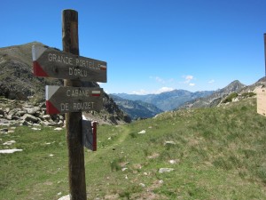
Hospitalet itself may not have had much to offer, but the campsite was pretty good – it’s the only one I’ve ever stayed on with wifi! One of the emails I picked up was from Di and Doug, who are a few days behind Klaas and me. They bumped into a park ranger at Refugi de Certascan (three nights after the lake where my tent was torn open), who told them that the imported bears are now successfully breeding with the native bears and the latest estimates are that there are 20-30 bears now. The ranger also said that the bears are definitely active in that area and, just like Pooh, have a penchant for honey – apparently they’ve been attacking local bee hives!
For the last three and a half weeks Klaas and I have spent pretty much every waking minute together, but today I left him behind in Hospitalet. We built up a really strong climbing partnership, trusting each other’s advice on routes across dangerous snowfields, tricky rock climbs and wet grass. At times I was even allowed to overrule the route in Klaas’s trusty GPS.
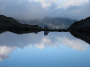
As well as a climbing partner, Klaas has become a great friend and I’ve missed having him around this evening. Sitting here totally isolated and alone by a lake at 2,400m I’m wondering why we didn’t carry on together until our routes diverged. (Apologies if this is all sounding a bit Brokeback Mountain, but we’ve been through a lot together!)
One thing I’ve learnt in the last six weeks is that I’m not cut out for this solo nonsense. I’ve loved meeting so many people along the route, and I’ve learnt from the master how to be a golden retriever.
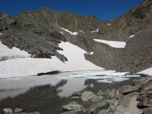
Today’s walk began well, but as I walked along the side of Etang des Bésines (first photo) I realised that, amid the emotional goodbyes, I’d forgotten to buy any toilet roll! I popped into Refuge des Bésines and was extremely grateful that the guardian there gave me some.
Since then I’ve walked round an enormous reservoir and up towards Pic Carlit (2,921m), which dominates the skyline behind my tent and is the target for tomorrow morning. In front of the tent is the picturesque Etang des Fourats, as shown in the third photo.
Tue 27 Jul 2010 15:18 » Klaas
Since the 4th of July, 23 days now, I’ve been dragged through these Pyreneen mountains by Jon…
Here, in Hospitalet pres de l’ Andorre, we have decided to go our own way for the last 10 stages, which in a way I surely regret!!
In the past weeks with many hard days Jon has proven to be a true friend on which a man can build; we had a lot of support of each other.
Together we have faced up steep scree slopes, large snowfields, high cols, hunger and thurst, cold and heat, thunderstorms, bear attacks, lost football finals and even wet grass……
But, a man has got to do what he has got to do and in an emotional way both of us agree to finish alone as it is the way we started this mountain traverse…..
I’m pretty sure that someday, somewhere we will meet again: experiencing all the callenges mentioned above created a band beyond friendship……
Tue 27 Jul 2010 07:17 » Jon
The weather has been a constant source of concern now for the forty-three days since I began walking at the Atlantic (I may have already mentioned it once or twice) but one thing we haven’t had to deal with too much so far is extreme temperatures. The last few days though have been grey, windy and unbelievably cold – we’ve been walking in fleeces, hats and gloves, and sleeping wearing socks and hats.
The temperature fell surprisingly as we arrived in Llorts on Friday, was even colder at Cabana Serrera (2,200m) on Saturday, and coldest of all at Refugi de Juclà (2,300m) on Sunday night. I don’t normally have anything hot for breakfast but the last few mornings I’ve been very grateful for the hot chocolate sachets that Sarah left me last week.
Waking up in a tent, the first question is almost always “Is there any condensation?” There doesn’t seem to be any consistency to the answer but it’s generally worse when it’s cold, unless there’s a decent wind, so we’ve been packing away wet tents the last few days.
The skies have been mainly overcast the last few days so the temperature has only risen very briefly when the sun has poked through the clouds, otherwise we’ve been keeping well wrapped up. We’re now at a campsite in l’Hospitalet-près-l’Andorre, and are still wearing almost everything we own. Somewhat surprisingly the other campers aren’t wearing as much, so we’re beginning to wonder if the reason we feel so cold is because we’ve got less fat to keep us warm!
We had a long day (by our standards) on Sunday, getting from the cabana to Refugi de Juclà, with three big climbs through the valleys opposite the ski-resort of Soldeu. Despite the cold, the tourist were out in force – we saw loads of families and some big groups too.
Yesterday was a shorter day but, after 10 days, we were both feeling a bit jaded so took it slowly and arrived in l’Hospitalet around 15:30. Both days were grey and threatening, but we’ve been quite lucky dodging the worst of the rain.
We’re now on a campsite, preparing for the final section of the trip, and dreaming of the sand on the beach at Banyuls-sur-Mer, which is hopefully only 10 days walk away. The other thing we’re preparing for is the break-up of the partnership, as Klaas is planning a different route to Banyuls and aiming to finish a few days later than me, so from here on we’re both going to be solo again.
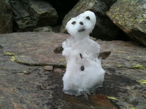
The first photo is a small snowman I had to build to keep the blog’s youngest reader (three) happy. Unfortunately snow is getting harder to find and he was crafted in the middle of a boulder field at 2,400m, so there weren’t any twigs to use for his arms. As a result the arms are made of stones and look a bit special, so I called him Joey.
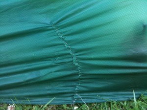
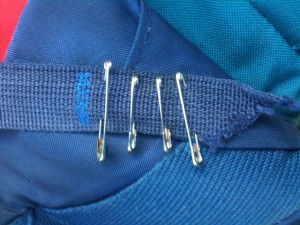
The second and third photos are to satisfy further requests regarding my abilities with a needle. The priority with both the tent and the rucksack straps was function rather than form…
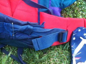
The fourth photo shows the mended hip belt, and also the bite the bear took out of my flip-flop!
Sat 24 Jul 2010 17:17 » Jon
After 37 days going back and forth across the border between France and Spain, we reached our third country on Thursday: Andorra. I’ve never been here before and don’t know a great deal about it, but I learnt the other day that the official language is Catalan. They learn that together with French and Spanish at school, and most of the people we’ve met seem to speak English too.
Speaking of Catalan, we met some kids from Catalunya at the campsite in Arties. They seemed as keen as the Basque people to be independent from Spain – they’d been supporting Holland against Spain in the world cup final, so were commiserating with Klaas.
Our recent run of poor form continued on the departure time front this morning. We beat our last two attempts, but didn’t leave the campsite till 09:00. I’d have thought the Dutch Army’s influence might have instilled some discipline in the team, but apparently not. Having left late, the situation deteriorated when we reached El Serrat: when we passed a cafe at 09:51 we agreed that it was far too early for an ice cream – “Not before 15:00″ said Klaas. Five minutes later we were sitting outside a second cafe eating Magnums.
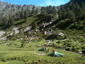
We did a fairly short walk today, up the beautiful Sorteny valley, which is famous for it’s wild flowers. At lunchtime we stopped near an unstaffed refuge called Cabana Serrera, pitched the tents (photo) and ate, then spent the afternoon washing clothes, mending kit and relaxing.
Walking through the villages of Llorts last night and El Serrat this morning has been a bit of a shock. For seven days we haven’t had any decent phone reception, haven’t seen a single bin, and haven’t passed a normal village. It’s been a relief to make contact with the outside world and get rid of seven days’ rubbish – there seem to be bins everywhere now!
Since we began the “wilderness” section I’ve met seven Brits, compared with two in the entire trip before that, and including a guy from down the road in Fulham. Today we met a couple from even closer – Chiswick. It seems the wilderness is popular with people from West London…
Fri 23 Jul 2010 20:46 » Jon
During the first ten days I got used to walking in the rain, but I never had to pack up and set off in the rain, partly due to luck and partly because I stayed in refuges so much. For some reason walking in the rain is OK, but setting off is a different matter.
After we left the refuge and pitched our tents on Wednesday night the rain returned, and carried on through till Thursday morning. Neither of us had the courage to pack up until there was a gap in the rain, so we didn’t get moving until 09:30. Even then we were warily watching the clouds, trying to predict when we’d get soaked.
We were actually quite lucky, and apart from the odd spit, we didn’t see much rain until the afternoon. Even then there were only a couple of showers, but in full Gore-tex we got through unscathed.
After a break at Refugi de Baiau (2,517m), we began the climb up to Port de Baiau (2,757m). This was similar to the 78% climb I mentioned a few days ago, with one vital difference: that was on grass, while this was on a combination of boulders and extremely mobile scree – so mobile that at times we went backwards. It was incredibly hard work – probably the toughest climb of the trip that didn’t involve snow.
We had a fairly easy walk down from the summit to Refugi de Comapedrosa, where we met the English gang we’d spent Tuesday evening with – Andy, Sarah and Steven – and also another Brit doing the HRP, Barry. Klaas and I joined them for the evening meal in the refuge and discussed how to survive in lightening, but decided that after some poor nights’ sleep in refuges recently, we’d camp nearby. This seemed like a good decision until about 01:30.
The last few days there’s been a lot of counting the gaps between flashes of lightening and thunder to work out how far away the storm is, but last night this became completely irrelevant, as all hell broke loose directly over our tents. It was the biggest, brightest, loudest, heaviest, most intense and most terrifying storm that I’ve ever experienced.
For the first half hour it was normal thunder and lightening – enough to wake me up through my ear-plugs, but nothing unusual. At 02:10 though, the rain and thunder subsided, but the lightening intensified. I began counting the seconds of constant lightening, but after one hundred I gave up and started using my watch. I desperately wanted to stick my head out and watch what must have been an amazing display, but after the earlier conversation I was a little concerned that if I sat up then I’d be instantly fried.
After seventeen minutes of lightening flashes no more than a few seconds apart, the rain returned, the thunder became louder than ever, and they were joined by hail and a gale-force wind.
The combination was terrifying. The hail became so heavy that it was hitting me through the tent, even though I was lying down. I ended up in the foetal position, in the middle of my tent, where it’s highest, desperately hoping that the pegs would stay in the ground and the tent would stay upright.
After about two hours the storm subsided and I got some sleep. There were a couple of minor thunder storms (directly overhead again) as I woke up, but nothing to compare to the big one.
We joined Andy, Sarah, Steven and Barry for breakfast, and they were quite relieved to see that we’d survived! They’d been watching the storm from their dorm, when the lightening had hit the refuge’s conductor – apparently there’d been a loud bang and the window had blown open, allowing the rain in “like someone had pointed a firehose at us”.
Luckily the rain gradually died away. Klaas and I took a while to get over the trauma of the storm though, and ended up talking to another group that had been camping nearby. It was their first night, and when they heard that we’d been walking for weeks they asked whether this kind of weather was normal. Klaas said “Yes, pretty much every night”, and one of the girls started crying.
We didn’t leave until 10:00, but had another good day, beating the guidebook’s times easily. We had some sun during the day, so all the kit is dry again, and this evening we’re on a campsite with warm showers, so we’re feeling a lot more relaxed than in the early hours!
Wed 21 Jul 2010 18:10 » Jon
Although section 4 of the HRP only has one staffed refuge, Klaas and I decided when we were making our plan in Arties that we’d take maximum advantage, to reduce the weight of food we had to carry. As it happened, the refuge fitted perfectly with my birthday, so yesterday at about 14:00 we arrived at Refugi de Certascan and started eating.
After a lunch of salad, lentil casserole, canneloni and cake, we spent the afternoon chatting, then had soup, pasta and a rather bizarre course of sausages and crisps, before finishing off with a chocolate dessert. This morning we had a decent breakfast and left with an excellent picnic lunch, so altogether saved ourselves the weight of four meals.
During yesterday afternoon a group of three English walkers arrived, so we spent most of the afternoon chatting to them. One of them, Steven, lives down the road from me in Fulham, is a doctor at Charing Cross A&E and treated me earlier this year! So much for the wilderness…
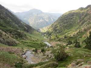
Yesterday’s walk passed through a bizarre hamlet called Noarre, which has no road access. It appeared to be totally deserted, but apparently most of the houses are holiday homes now so that’s not too surprising. Still, we wondered how they get anything there, and whether they have any electricity.
We had a long climb up from Noarre, then crossed over Coll de Certascan (2,605m) and began the descent to the refuge. Not far from the top we reached the biggest and steepest snowfield we’d seen since we sent our crampons home. I lead it rather nervously, and the tension wasn’t helped when I turned round to see Klaas sliding towards me on his arse. I had a couple of nanoseconds to consider the etiquette involved with stepping out of the way and watching him accelerate towards the rocks but, before I’d reached a conclusion, he crashed into me and came to a halt.
There’s been no snow to deal with today, but we’ve climbed down the beautiful gorge of the Riu de Romedo from Estany Romedo de Baix, then up through some welcome shade in a forest. The sun has been behind clouds for much of the afternoon, and as we dropped down from Coll de Sellente (2,485m) to the Baborte lakes where we’re camping, it began spitting. We hid in the refuge for half an hour or so while it rained quite heavily, but there were already 18 people vying for the 9 beds, so when the rain stopped we set up the tents and have now eaten and washed, so all is well with the world.


